The 10,000-Mile Tour: An Aspen Cruising Adventure
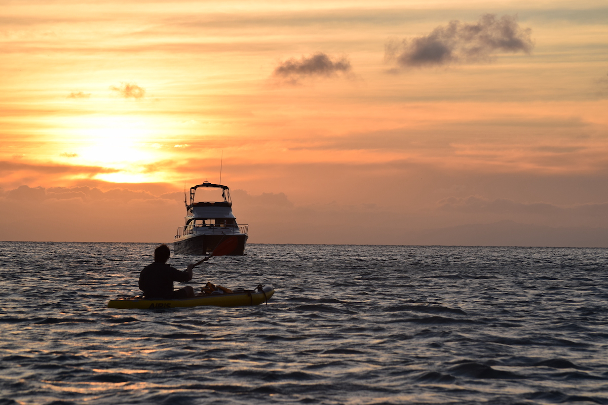
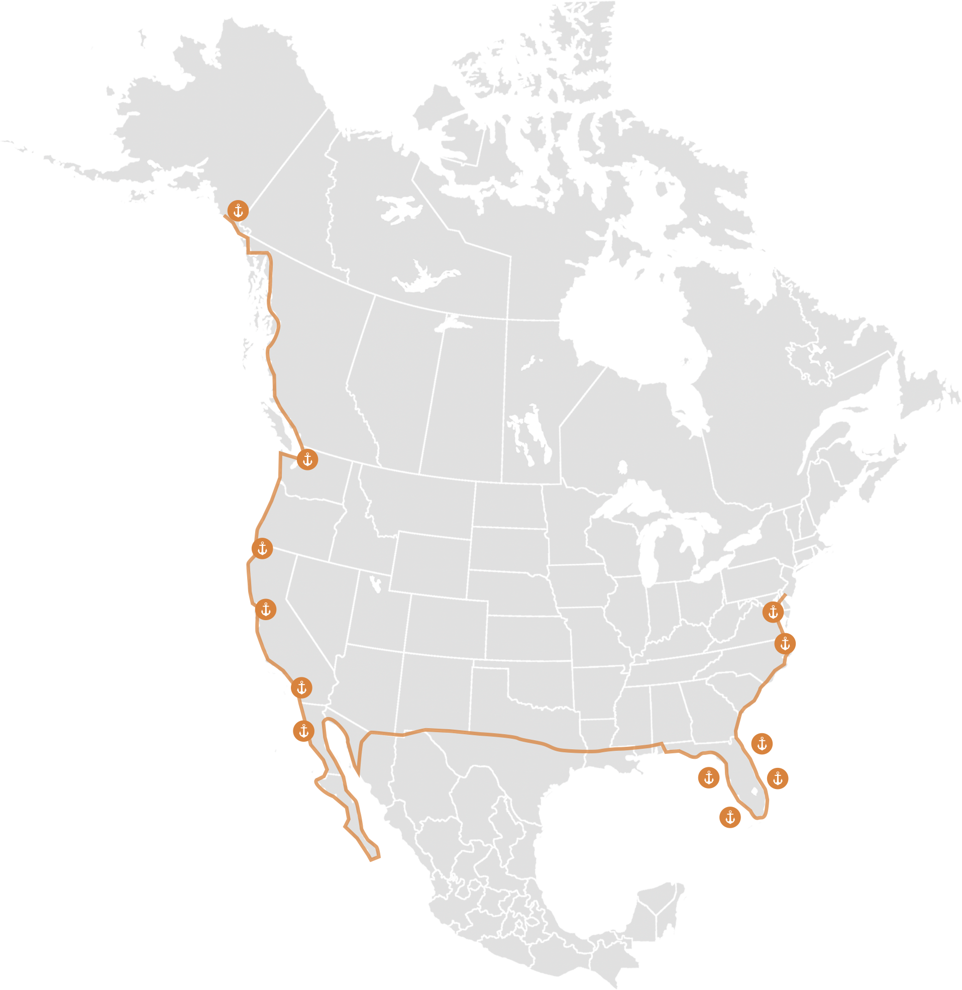
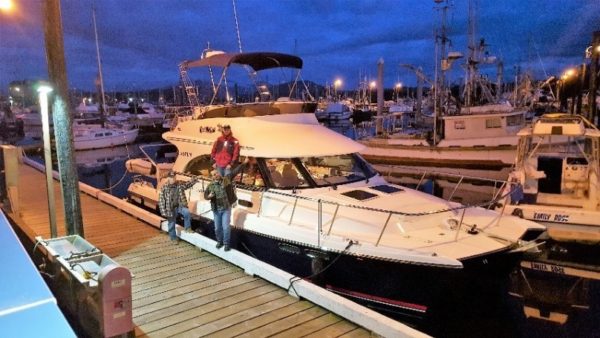
From May 2017 to October 2018 the owners of a brand new C120, David and Sue Ellen, delivered their new 40 footer on a journey of epic proportions. Partnering with Aspen and David’s brother-in-law, Blake of Bristol Boat Delivery, the team took the C120, Knot Wafflen’, 10,502 miles from the Pacific Northwest to Annapolis, MD.
Learn More About Why This Voyage Happened in This Video
Here are the Stats for the Cruise
Mileage: 10,502
Average High Cruise: 17 kts
Trawler Cruise Speed: 8 kts
Max Speed surfing down the CA coast: 27.8 kts (32 mph, per Garmin)
Trip Average Fuel Economy: 1.48 mpg
Engine Hours: 1,058
That’s a lot of boat driving, a lot of navigating, a lot of anchoring and a huge adventure. Everyone loved the trip, the high points were South East Alaska’s Glaciers Fjords, waterfalls and wild life. The low points were when Sue Ellen broke her wrist hiking a slippery slope near Bella Bella BC, Dixon Entrances-big seas, and one day off the northern CA coast when one monstrous wave managed to break in the cockpit.
But when you review the trip book Blake’s daughter made based on the trip blog and photos, it clearly shines as the trip of a lifetime for the team. Knot Wafflen’ came through with flying colors, no engine failures, no structure issues, not even a gel coat fracture. “She looks brand new” was the most common comment by show goers in Annapolis – inside and out. After such an intense year of boating, David and Sue Ellen will be taking a break from boating and had Aspen list the boat at the Annapolis boat show. Six hours into the show she sold to Robert and Judy Cope from Medford, NJ. The Cope’s plan to cruise and explore the Atlantic coast and the Bahamas. Knot Wafflen’s raring to go!
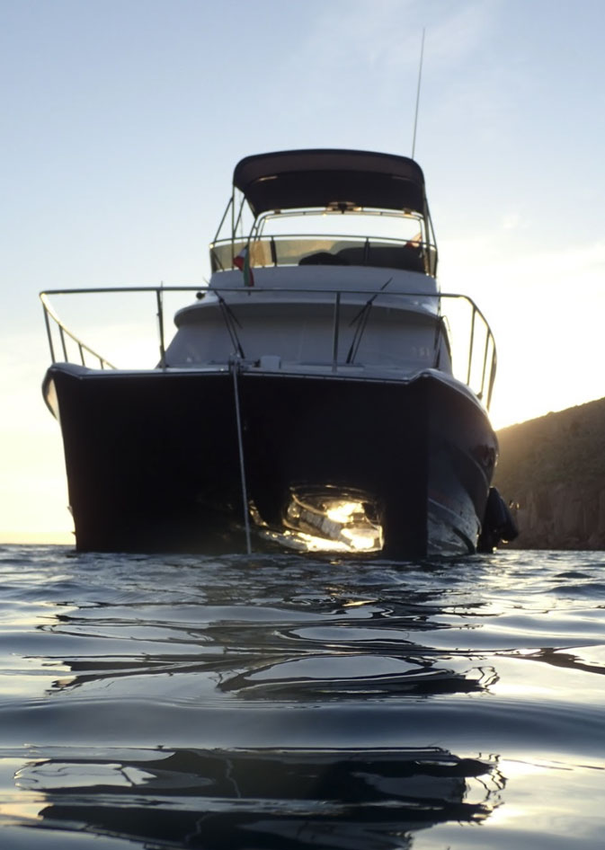
Equipping a Cruiser for the Adventure of a Lifetime
Volvo D6 435
Bomb Proof reliable, never skipped a beat. She did slow down one day due to a clogged primary fuel filter, but other than that she started first time every time! Solid, powerful, reliable, LOVE IT!
Garmin Electronics
A joy to use and amazingly helpful. We were constantly in areas for the first time, but the system and BIG displays made that easy and fun! Their support was fantastic, most of the time when we thought we had an issue it was uninformed operator issue. (We hate to read the manual)
Balmar expedition alternator
This was the one component that we had multiple failures on (3) in first 3 months. Before the boat left for Mexico we swapped out for a Volvo alternator and never had another problem. The Balmar team did warranty the parts and, in the end, found they had a bad batch of diodes.
11ft Walker Bay / Honda tender
What a fun TOY, able to pick up two people and fly down the bay at 22+ Mph. Super reliable and pretty good in heavy seas.
Iridium/Serous Satellite Phone
Another handy tool: but built in antenna we installed didn’t work, standing on the back deck did, with the flip up antenna and she worked 95% of the time. Deep Fjords not so well.
SinglePoint Wi-Fi
Amazing, we had cell/Wi-Fi service 20 miles out to sea and in 85% of the crazy places we went.
Aspen’s 10,000-Mile Tour: Alaskan Grandeur!
By Larry Graf
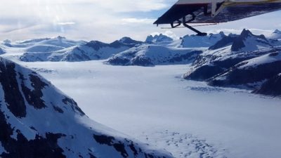 We just finished a two-week tour of north and south of Juneau, Alaska – an area of the country that has one of the most remarkable concentrations of grandeur. Not only were the sights and wildlife amazing, but equally incredible and fun were the Alaskans we met along the way – always helpful, always sharing the best sights, and always ready to jump in. Alaskans have a vibrant attitude about life that’s contagious; and with the sun not setting until nearly 11:00pm each night and rising around at 4:00am…wow, you can see and do a lot in one Alaskan Day!
My crew for this leg of the 10,000 Mile Tour included Peter Robson writing for Pacific Yachting, Brian Lind writing for PassageMaker, and Brandon Holmes – my son in-law, a farmer, and an amazing mechanic.
Our trip started on June 14th with a meeting with Knot Wafflen’s owners, David and Sue Ellen Jenkins and their Captain, Blake Eder. On May 8th, they began their tour with the Aspen C120 in Seattle and Anacortes, Washington – making many stops and creating many adventures along the way. In total, over 2,100 miles of exploring! At our meeting in Juneau, David developed a short punch list of details that needed to be addressed on the new boat and had great advice on where to go for the best of Alaska.
David’s advice combined with several Aspen Owners’ input and strong feedback from Steve Birkinbine, of Nordic Tugs Charters, had us revising our original trip plan. Our first planned stop at Glacier Bay National Park was dropped from the itinerary after a thoughtful crew discussion. Between the entry permit scheduling, classes on wildlife avoidance (mandatory three hours), travel regulations, zone closures for wildlife, and 8-mph speed limit in much of the 65-mile-long bay, were too much. Especially with so many other possible areas to visit nearby.
Our first day in Juneau started out a bit drippy and overcast, but by 1:00pm, the sun started to peak through. Talking with the locals, we found that it had been raining for days and was forecasted to rain again later. Having been to Alaska before, I knew we had to seize the opportunity, so we started looking for a float plane tour of the surrounding glaciers and mountains. We made a few calls to find that they were already booked. But while talking with Steve Birkinbine, I asked him on an off handed thought if he knew of any flight seeing tour companies in the area. Wow-did Steve light up! “I have just the captain and company for a world class flight,” he said as he called Ward Air – who got Steve’s preferred pilot Kyle scheduled for a 6:00pm flight, when the “sun’s just right.”
By the time we arrived at Ward Air (thanks, Steve!), the sky had cleared to a pure blue, it had warmed to a nice 72 degrees, and the winds were calm: just perfect for a tour of the nearby ragged snow-covered peaks, glaciers, and ice cap, as well as Turner Lake. Only one thing missing…so on the drive over to the float plane near the main airport, Steve called for an emergency stop to pick up a case of Corona for the ride. Our plane was a Radial Engine Beaver minted in 1957, same year as myself, therefore in perfect condition! With the captain, all six of us hopped in, Steve passed out ear plugs (because radial engines ROAR), and we were soon lifting off in to a perfect summer evening.
As we climbed out, we had a view of Juneau and six cruise ships. Then Kyle cut over town and began to climb hard for the summit above Juneau and the ice cap. The views of jagged, lush, rich green mountains gave way to a huge ice field (approximately 10 x 35 miles), flowing below rocky peaks. We glided by low with the sun turning the scene a touch golden; what an amazing sight – ALASKA ROCKS!
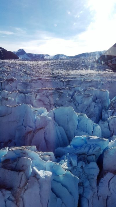
We continued touring the ice fields and then followed one flow down the mountain to where 300 feet thick Ice Blocks broke into the bay – what an amazing sight! Next, Kyle climbed up over a ridge and banked hard into the Turner Lake Valley surrounded by steep mountains. We settled down onto the lake right next to a 1,500-foot waterfall. Kyle killed the engine, and we stepped out on the floats for up-close photos of the falls. It was so green and warm it almost felt tropical. If you find yourself in Juneau on a warm sunny day, this is a trip you must make. Interestingly, right after we left, Juneau had a three-week-long stretch of cloudy, damp weather in which no flights were possible. This float plane flight was the perfect start to a grand adventure!
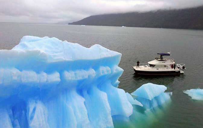
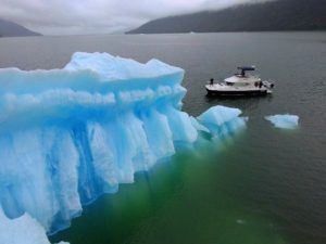
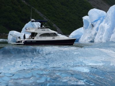
The next morning, we conducted a brief test flight of our first Breeze Mini Drone (easy to fly and smart)! Then we pulled out of Auke Bay at 9:30am and headed south for Tracey Arm. It’s an 85-mile run to the entrance and we arrived by 1:00pm. We spotted our first icebergs just outside the entrance and as we were heading north toward Sawyer Glacier. So cool! The bergs come in all sizes and colors: some low, some tall, some deep blue, some nearly transparent. We pulled out our new drone and got some great shots with the boat in front of the biggest of the iceberg fleet. As we do the first of many photos shoots with the drone or the Walker Bay tender, I realize this is going to be one great trip. Not only are we in one of the world’s most amazing places, but the crew of Brandon, Peter and Brian is just great: fun and funny!
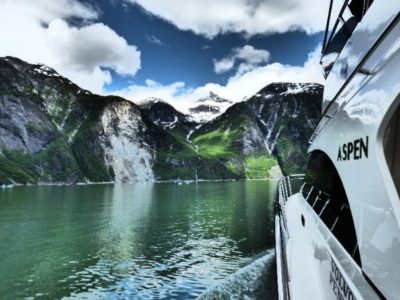
As we worked our way 20 miles into the spectacularly steeply-walled fjord, the temperatures (both air and water) dipped to about 38 degrees and the iceberg volume grew. We initially had to slow to 8kts, but as the bergs got thicker, we had to weave and dodge. In some sections, we were down to 1mph and even reverse to dodge bergs and burgee bits. Icebergs – even ones just 12” in diameter – are heavy (about 35lb) and make quite a thud when they hit the hull. Later in the trip, we talked with a diver who inspected a cruise ship that had made contact with an iceberg in one of the fjords; he said he found a sizable hole forward on the ship, as well as a VW Bug-sized berg still stuck in the double bottom hull! My goal with my loaner boat from David was no impacts – no big events to explain.
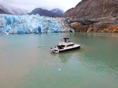
25 miles in, we made a hook turn into the mini fjord that holds South Sawyer Glacier. Another 2 miles in and the glacier face came into view…wow! Words can’t describe this well: the face is broken and ranges in height from 80 feet to over 180 feet, some areas are rich blue, others are darker, and some are dirty and full of gravel. As we near and slow down, we notice the glacier is alive with subtle activity. It groans and squeaks; rocks are tumbling, boulders cascade into the salt water at times, and every so often, a big slab cracks like thunder and plunges in – it’s very cool! We fly Breeze again (flight #3), take lots of photos, and soak in the grandeur of our surroundings. But it’s hard to stay too long as there is a steady frozen breeze flowing off the icefield and down the glacier. As we back away from the glacier, a 120’ tall wall face thunders and crashes into the water! Amazing – and we are the only people in the fjord to see it!
Our run out of Tracey arm was uneventful, other than it began to rain and rain Alaskan style (pouring all the way back to our anchorage in the small bay near the entrance to Tracey Arm). It’s a good spot to overnight on the hook: it’s generally protected and has a narrow entrance with shoaling on either side to keep the house-sized icebergs out. Meeting a berg on the bow in my jammies was not in the trip plan.
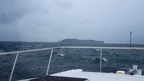
After sleeping well on the hook even with a downpour that lasted all night, we weigh anchor and pulled out into Stephens Passage for the run back to Juneau. Our plan was to leave early before the wind really came up, but the weather was up before us, we made our way into a very mixed up 3-6’ wind chop outside the entrance. With most of the crew still asleep, my plan elicited some grumbles as their beds began to move as the boat flowed softly up and over the seas. As we progressed the wind really did come up, stead to about 25kts with higher gusts. Initially this was on our front port quarter, but as we worked north up the channel, it became a stern quartering sea about 4-7ft. The boat rode these softly at about 16-17kts. About 20 miles north, Peter noticed Taku Harbor to our starboard and said, “Hey! Why don’t we pull in there to make breakfast?” The cruising guide had said there was a state dock and, as it turned out, we explored a very old fish processing plant that is slowly melting into oblivion, as the rain continued.
By noon, we were back at Auke Bay and refueling 173 gallons for 225 miles. Our itinerary had us running to Haines and then later up to Skagway that same day. But upon checking the weather forecast, there was some trepidation among the team. The forecast expected 25kts to build up to 35kts with gusts up to 45kts going into Haines and up to 55kts gusts in Skagway. It was primarily a stern sea forecast, and I was delighted to show the writers how the Aspen C120 did in the BIG stuff. So, I was good to go!
After a brief discussion, the team decided that Haines would be just fine for the night and, if gusts got really big, we’d slow down a bit. As we trolled out of Auke Bay, I remember thinking that Knot Wafflen’ would do just fine in these rough seas, but I wondered how docking in Haines would be with 45kt winds (a harbor I’ve never been to). As we entered the channel leading up to the Lynn Canal, the seas picked up to 2 feet, then 3 feet, then 4 feet, and by the time we got to Sullivan Island, we were running in a steady 4 -7’ sea with winds running steady at 35kts.
The boat was running like magic: climbing up the steep ones at 12kts and then surfing down the back side at 21 – 22kts. The bow would smoothly climb the next wave: no bang, no big spray event – just slicing along softly. After we did this for several hours one of the writers said, “This is great, but what’s it like up swell?” I turned off the Garmin Autopilot and swung her around – straight into the seas. She slowed a little to 16kts and then did the same thing she had been doing. The bow rise was a bit more aggressive as waves are more square upwind. But Knot Wafflen’ sliced right through. On this 75-mile run, we saw only two boats in route during Southeast Alaska’s busiest season: one a tired, old 40’ fishing boat bobbing around like a cork, swaying back and forth at 7kts, and one a 200+ft Alaska State Catamaran Ferry running north at 35kts, smooth as a hovercraft.
Haines – our stop for the night – came into view with a misty salt fog skimming across the ocean surface. We were looking at old Ft Seward and the town as we entered the rock-walled breakwater harbor entrance. The turning basin inside was a good deal smaller than I had expected and, as I sized up the docking situation, mother nature had her own plan for the boat. Things began to happen very fast. Plan A. was a guest dock to starboard; we started to make our way starboard but within seconds it became clear we weren’t going there. The thrusters had very little affect against the 40+kts winds coming over the dock. Then, a fisherman hollered, “There’s an empty slip about 10 slips down that fairway just ahead.” Great, Plan B! But then he added, “I think you’ll fit.” Think?! In these winds? This was not a good time to find out. While this is going on, the winds began to really push us sideways and I had to use BIG bursts of thrust and the oversized rudder to swing us away from a yacht to port, but we’re about to lose that battle. But then I see about 30-feet of open dock just behind the yacht and holler to the guys, “Fender port! We’re taking the space behind the yacht.” They noted that it looked too small. “It’ll work, trust me,” and just before we touched down, I had both thrusters pushing away from the dock at full power and we still came in at 3 mpg with the boat’s center of windage just forward of the end of the dock. Plan C worked – all in about 120 seconds!
In hindsight, I probably should have fendered up both port and starboard prior to entering the harbor – but there’s always next time. We spent the night in that slip, and the harbor master said, “It’s not exactly guest moorage, but with this wind no one will be coming in.” We toured Haines, saw the museum, and had dinner. The friendly town people were in a great mood: they’d had 21’ of snow that winter and were happy to be into summer. The mountains’ snow caped peaks seemed to just pop right out of the ground behind the town – a grand place with a small, working town feel.
After a windy, wet night, we awoke to clearing skies and more wind: this time only blowing about 20-25kts which made getting free of the dock and maneuvering much easier for our 15-mile trip north to Skagway via the Lynn Canal – a wonderful, waterfall-filled fjord.
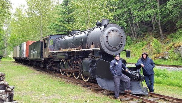
We arrived at Skagway at about noon and made our way to the historic White Pass & Yukon Railway (I LOVE old trains). Brandon and I bought tickets while Peter and Brian toured the town and the museums. The railway has both diesel and steam locomotives; on the day we visited, they were running diesels. The cars are period cars from the late 1800s with big windows, good seats, and friendly tour guides. The railway heads up the steep pass with views of the town, crashing creeks and rivers, as well as the high alpine with sweeping views of the surrounding mountains. It’s a narrow-gauge railway common to the time frame so it sways a bit but it’s a great trip: the tracks literally hang on the side of the mountain in some areas!
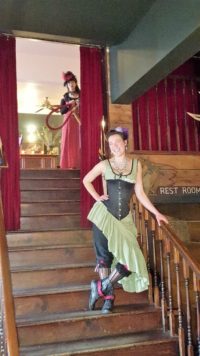
Next was touring the town. Some would call it a tourist trap, but it’s done very well: complete with saloons with can-can girls, brothel tours, a playhouse – with a play about early gun fights and thievery, several museums, great parks, a historic cemetery, and lots of jewelry stores. All of which were done in turn-of-the-century architecture with a slight Russian influence. A special place! If you go be sure to say, “hi!” to Katlyn at the Red Onion Saloon and Brothel!
By this point, it was Saturday morning and change over day: Brian and Peter hopped on a small commuter plane for Juneau and then flights home. Brandon and I did some house cleaning, refueled (65 gallons for 90 miles (in heavy seas)), and then headed down the Lynn Canal for Juneau. What a difference a few days makes! The trip up had been in 4-7ft seas and often heavy rain and low overcast. As Saturday progressed, we had clear, blue skies and 65 degrees to just sit back and soak in the grandeur of Southeast Alaska. We saw waterfalls, snow caped peaks, and glaciers!
In terms of wildlife, we saw sea otters, bald eagles, killer whales, and a lot of salmon jumping. It was a salmon gill net opening, so we also saw lots of fishing boats and many nets with little white floats on mirror smooth waters – which we worked our way through on our trip south.
As the sun was starting to grow golden, we rounded the south point on Douglas Island and Juneau was in sight. After catching a guest slip in Harris Harbor, it was lights out. The following morning Brandon had an 8:00am flight out. While waiting for Roger MacAfee (writer for Sea Magazine) and my son Nick to arrive, I re-provisioned the boat with food and fuel. We were then ready for week 2 of fun and adventure!
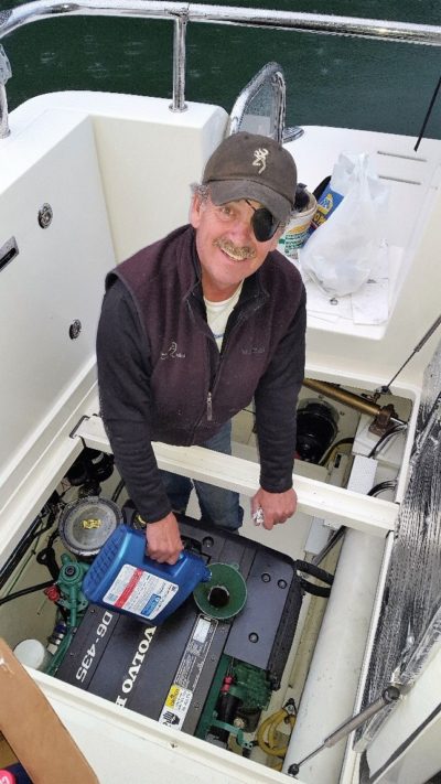
On Monday afternoon, with Roger and Nick, we toured Downtown Juneau then had some beers with Steve, and got additional advice on entering Ford’s Terror. Several friends recommended this fjord, located off Endicott Arm south of Tracey Arm. The entrance is tricky, complete with boulders and 10’ tidal rapids at peak flow. I called Steve again to see if he might know a mechanic who could do an oil change for us. Again, Steve had just what we needed and set us up with his friend Mark. Mark is a character, complete with eye patch, but a first-class mechanic… also a gold miner and has a few other professions! He arrived at 8:30pm with everything needed and was done by 9:30 – just as it began to rain hard! At which time we asked if he could use some refreshment; this began a rich 2-hour-long chat about his gold mining claim above Haines (yep! It’s got gold!), politics, sights to see as we head south, Southeast Alaska’s weather and boats!
 On Tuesday morning, we were underway at 7:00am to top off the fuel tanks for this leg. It would be over 225 miles before the next fueling in Petersburg. The weather was a bit damp with winds from the south west at about 15kts. Roger was impressed with the commanding view from the helm seat and equally as impressed with the Garmin suit of electronics, the speed of updating, screen clarity and volume of information available at a glance with three screens running. The auto pilot was also following a track it had developed on its own in auto guidance as we made 17kts down Stephens Passage.
By 11:00am, we were at the entrance of Tracey Arm and the guys were amazed at the volume, color, and size of the icebergs floating out of the inlet. By 12:30pm, we were headed in to North Sawyer Glacier. Here, the ice had been solidly blocking the north glacier the prior week, so it was virgin territory. On our way in we played tag with Mola Mola, a 58’ Fleming. The sun was popping out and we soon got in deep enough where the icebergs were surrounding the boat and the glacier was starting to glow in the sun: a great time for a photo shoot!
So, we pulled out the Breeze drone and got her up. Just as she lifted off, a shower came through and my phone screen got very wet. The drone began to fly erratically, first south – then north – then it made a beeline directly for the Fleming about 1000 feet away! Of all the places to fly I’m going to hit a Fleming?! All the while, I’m trying to push the control buttons on my phone screen. Occasionally it had an effect, but often not. As it neared the Fleming, I hopped on the VHF and asked Mola Mola if he could catch my drone. He agreed as it was hovering within just a few feet. But then the low battery alarm came on and the drone began to fly back home to where it had launched – only we weren’t there anymore! We had drifted in the ice. As I tried to control the flight of the drone, I had Nick move the bow of the C120 back under Breeze. And with the low battery alarm sounding, I pushed the down button and the drone dropped on the front deck – great!
But then she bounced once and slid slowly into the water, blades turning, and then sunk out of sight in the glacial till-filled waters in seconds! Darn! We had downloaded all the content from the prior three flights so not all was lost. My second Breeze now has foam floats on its feet – we’ll see how they work. I’m still not sure if it was the water on the screen or the steep fjord walls blocking the GPS signals that was at the root cause of the drone’s behavior. For drone #2, I have ordered a controller module, like those used on RC aircraft with separate joy stick controls.
 After re-grouping from the drone excitement, we headed back 3 miles to South Sawyer Glacier and made our way in to take another look. Again, this one is impressive! Having been there one-week prior, it was interesting to note that while the glacier had continued to calf, the actual point of the break was still about the same as the prior week. As hard as it is to imagine, the huge rock-hard wall of ice is still flowing out and breaking off.
After spending the night in the No Name Bay at the entrance of Tracey Arm, we headed out at 9:00am for a run south up Endicott Arm to Dawes Glacier – our third big tide water glacier of the trip. It was about 25 miles in and different to the other glaciers we had seen. But it was very special in its own way: complete with lush, green hanging valleys, waterfalls and lots of ice. We explored the glacier, but then had to exit quickly to run back down Endicott Arm to catch the slack tide at the entrance of Ford’s Terror – a mini fjord about 6 miles long with vast rock walls 4,000 to 5,000 feet high with surrounding snow-caped peaks. It’s an area that was highly recommended by nearly everyone we talked with. The narrow entrance at Ford’s Terror is a cut in the rocks; it has shoals and big boulders at low tide. Due to the 18-25 ft tides, the entrance can only be traversed at high slack tide, so once in, you must stay for 12 hours. But exiting is not something you want to do in the dark so 24 hours is typical. The current really flows in and out of this cut, and at times, there can be a 10ft tall standing wave: not the place to even think of passing during the roaring tidal flow.
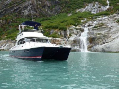
As we entered, the tide had just begun to flow out and it was smooth sailing. As you work your way through the passage it opens into a lush, almost tropical feeling, canyon with waterfalls sliding down long rock faces into the bay. It was unlike anything I’ve ever seen…so amazing! I don’t think we even got above 6kts as we trolled into the anchorage, just dumbfounded by the views. As we got the hook down, Chris, the captain of Venture, Tony Fleming’s boat, stopped by to invite us over for drinks that evening with the crew of Mola Mola, another Fleming.
With it raining so hard outside, drinks and chatting with Tony, Chris and the owners and crews of the three boats was good fun. Tony builds quite a boat and ventures far and near – something I can relate to. We toured his boat and the next morning he and Chris toured the Aspen, just boat nuts talking boats – good fun, good people.
 Thursday morning dawned dry Nick and I had time to run over to a second inlet to explore before the tide. A little fishing and touring is always fun. The Walker Bays Honda 9.9 ran flawlessly on the way over but as we returned to the C120 it was only able to Idle. I thought Humm Not good. But with the tide coming now was not the time to dismantle and engine. Our exit from Fords Terror was just as easy as coming in.
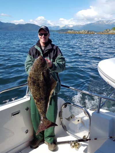
With the clearing weather, we ran north up Endicott Arm and rounded Point Astley, we stopped briefly for Nick to get his line wet. Within 15 minutes, Nick had a 35-pound Halibut on the deck! We then picked up speed and ran south down Stephens Channel for Petersburg 66 miles south. In all, it was a 5-hour run, but the time flies by when you are constantly awed by the amazing scenery.
As we neared Petersburg, we encountered more icebergs flowing out LaConte Glacier and a killer whale pod rolling through schools of salmon. The harbormaster was open for business even at 9:00pm. Petersburg has a large, very active marina and a clean well-kept town full of amenities for boats, as well as a Scandinavian feel that’s just nice. Every person I met was happy and helpful. We needed a few boat parts and so I did a little tour of town. The NAPA parts store owner, after finding he didn’t have what I needed, gave me a lift to the store that did. I love small towns!
Many of the fishing boats in the marina have an oversized Disney look to them. They are 58’ limit seiners where the length is limited but the height and width (beam) are not by the regulations. To maximize capacity, the fishermen have pumped up the other two dimensions to the max: the boats end up with just huge proportions, some 58’ long, 20’ wide, and 15-18’ tall.
By 5:00pm on Friday afternoon, we had finished our boat details (the Honda 9.9hp had sucked in a paper towel that had been placed under the cowling to soak up extra Boeshield) and picked up Norris from NW Yachting. We were fueled and ready to run down the Wrangle Narrows. This is an odd 20-mile-long channel between two islands that seems very much like a river for most of its length: large and small boats go through. It’s well-marked but very narrow in some spots and 1000 feet wide in others. It’s the preferred route as, to the east, the large saltwater bays have been mostly filled in by the Stikine River outflows, leaving almost no safe channel.
We encountered water ski boats and fishing boats of every size, shape, color and age as we transited. The fishing was good, and we saw two landed as we passed. At the south end, we made a turn northeast for Wrangell – no reason to go there other than none of us had ever been. We made the 50-mile passage into yet another golden, seemingly very long Alaska twilight. Again, the harbormaster came down to get us tied in snug and secure at 8:30pm.
We grabbed our cameras and hoofed it up the gangway for a tour of town – one never knows what the weather will be the next day in Alaska. Wrangell is a working town: clean, organized, and complete with groceries, hardware, and even two taverns with food that were open. We found a building with two Totem poles, that looked like they were under reconstruction, and a city park that had a Friday night barbeque going on.
What a change Saturday morning was! We awoke to near zero visibility and pouring rain that had started at about 2:00am. After breakfast, we made our way out of the harbor and turned north to thread our way around the top of Wrangle Island and explored Eastern Passage. While it was wet, it still felt special. The area is mountainous and, in some ways, it again seemed like this waterway should not be here. The channel flows along, with some areas feeling like a river. Others, like a mountain lake, were complete with waterfalls dumping in, tall moss-covered trees, deep grass, and wetlands near the salt water. It’s an odd combination of mother nature packing a great deal in such a tight space.
 As we exited we anchored in Anan Bay, while Nick and Roger fished, Norris and I took the Walker Bay into shore and hiked up to the bear observation deck. We just missed two bears, but we did inspect the biggest bear poo I’d ever seen. I’m just fine having missed that one.
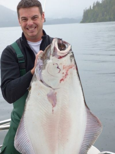
On our return to the boat, the rain ended and Nick surprised us with a BIG 50-pound Halibut. Ketchikan here we come – the last 60-mile leg of this journey! With clearing skies, we headed south down Ernest Sound and as we cleared Lemesurier Point, the wind filled in from the south and we ran into a head sea, that at its peak, was 3-4ft and 20+kts. By 8:00pm, we were clearing the breakwater in Ketchikan.
What a trip! Southeast Alaska is one of America’s most densely packed areas of natural wonders. The earth’s crust in this area is just buckled and bursting right out of the ocean and then inland for 80-150 miles. These mountains are 5,000 -18,000 feet high combined with channels and fjords allow unprecedented access to their hidden features. If you get the chance to cruise this area in a small boat, take it – but bring your umbrella!
Read Articles About the 10,000-Mile Tour
Power & Motoryacht – August 2018
